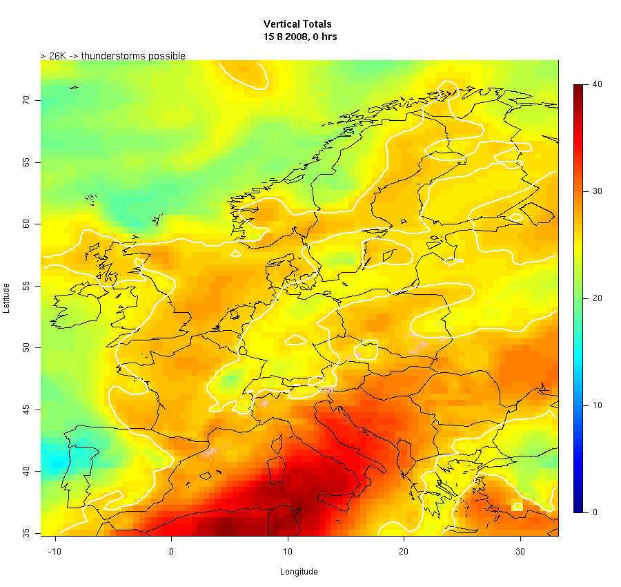
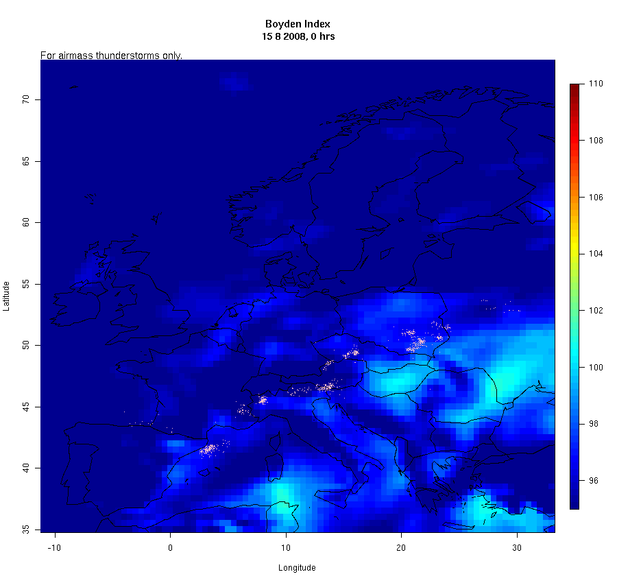
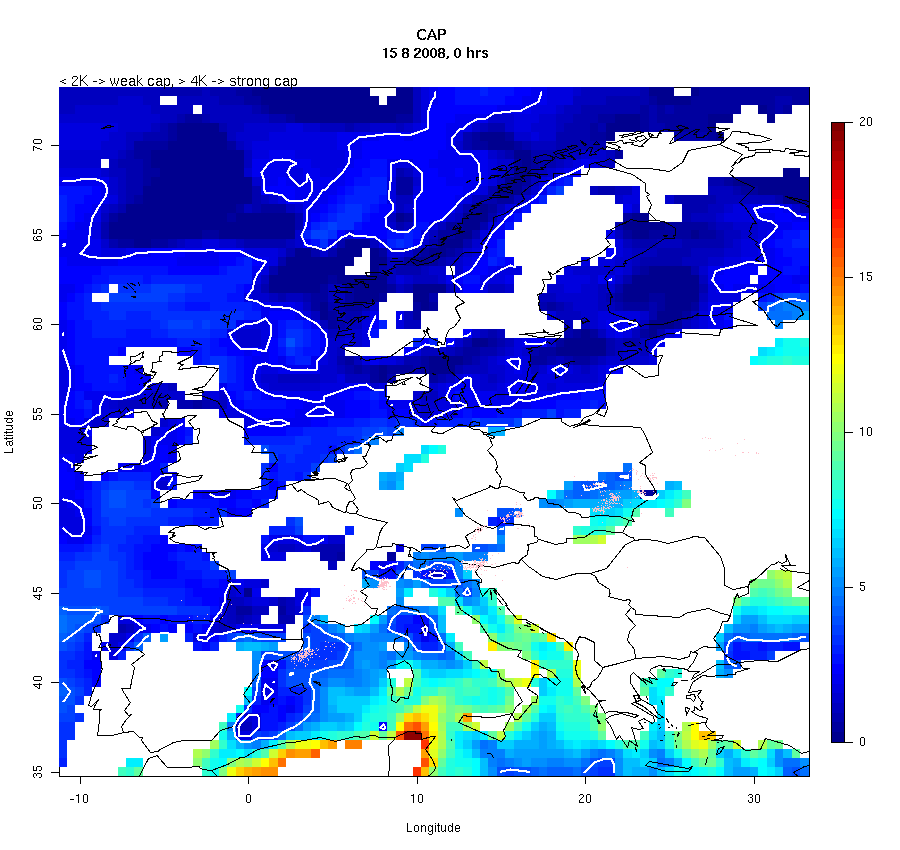
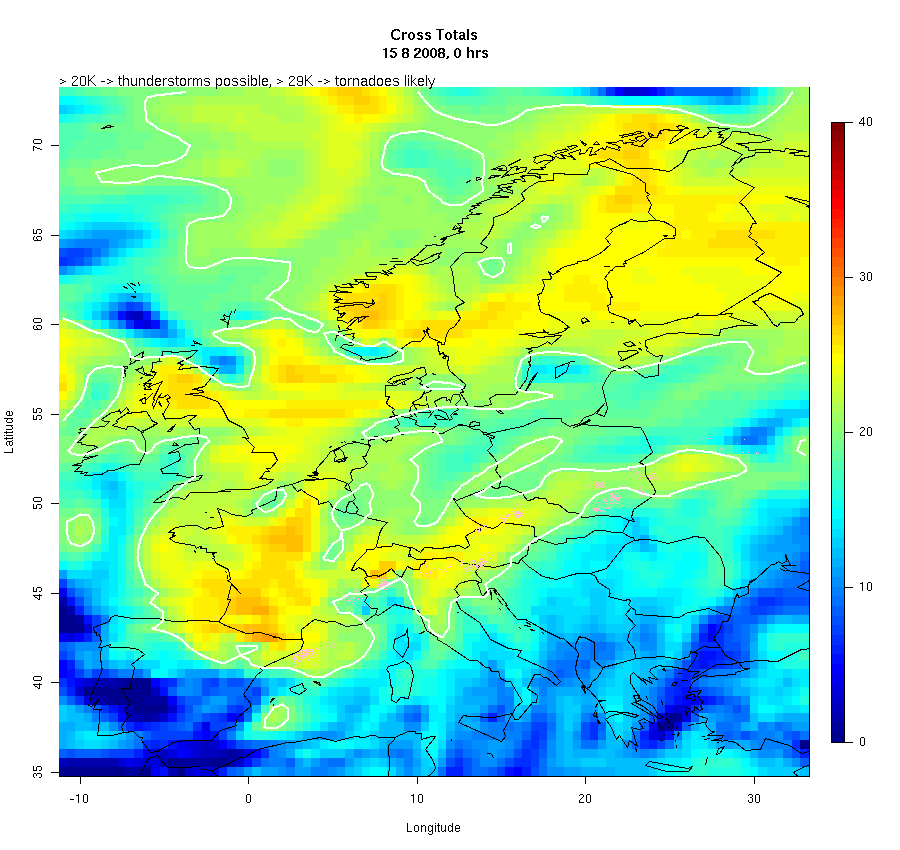
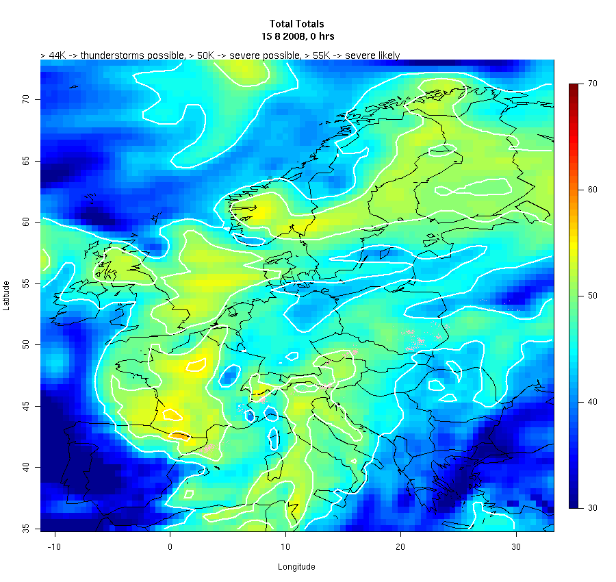
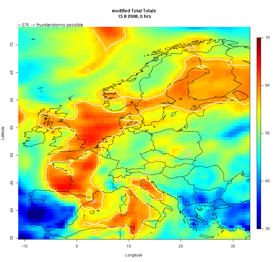
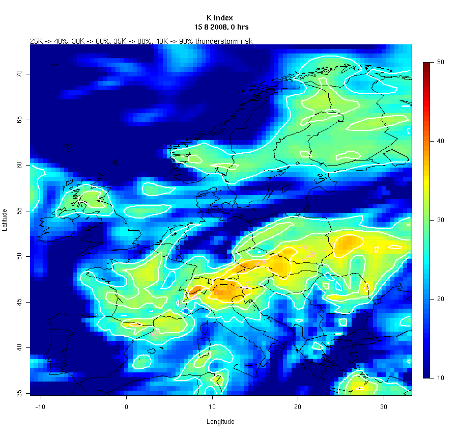
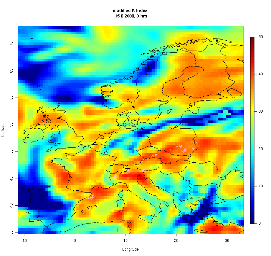
Calculation of Convection Parameters over Europe for 15th August 2008
|
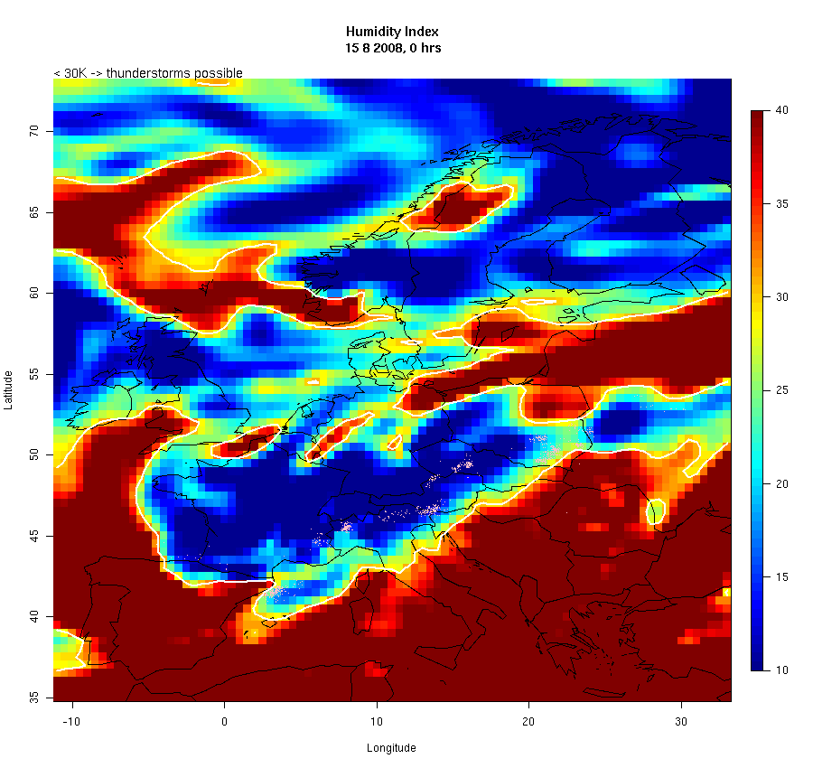
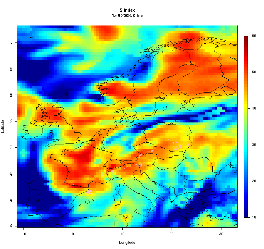
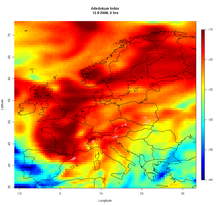
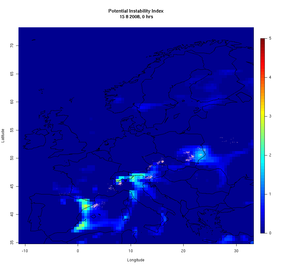
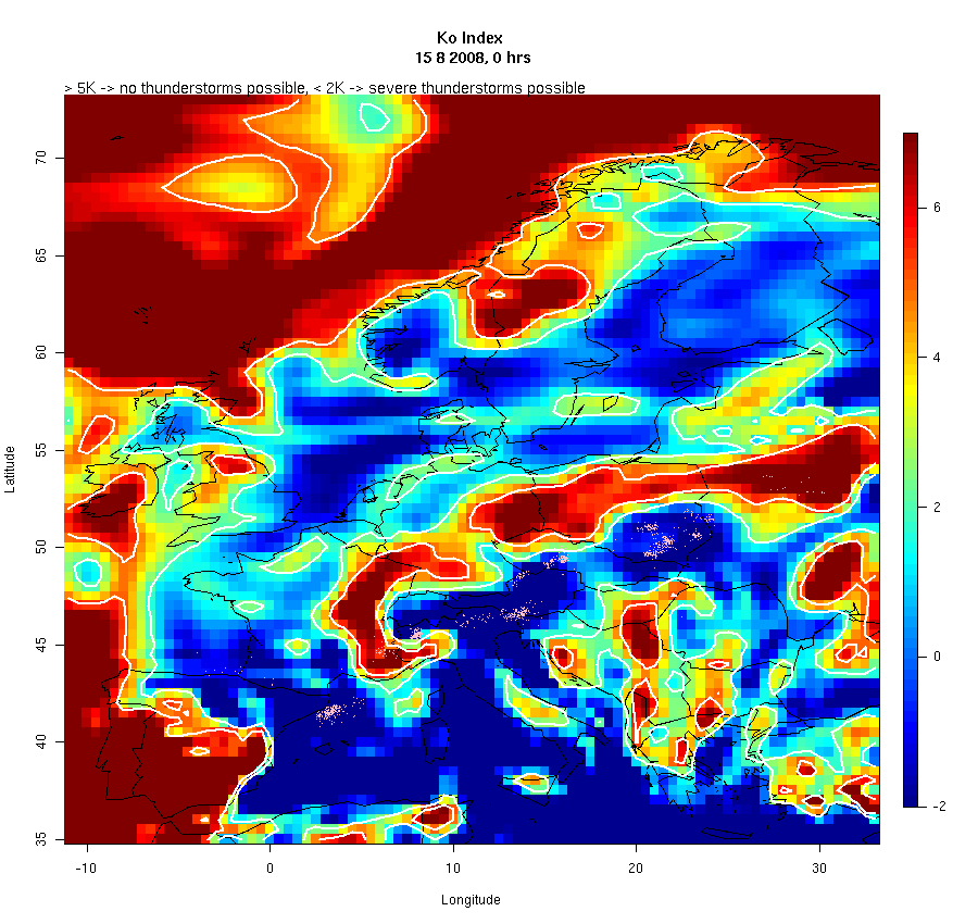
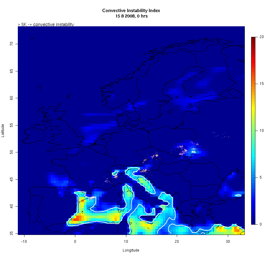
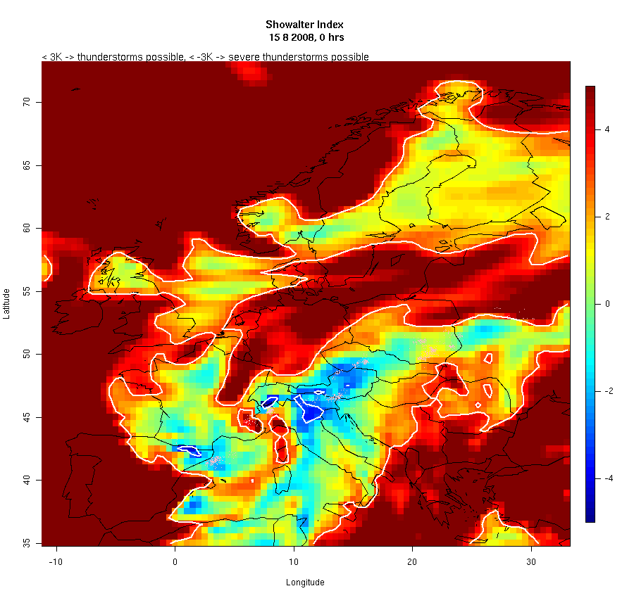
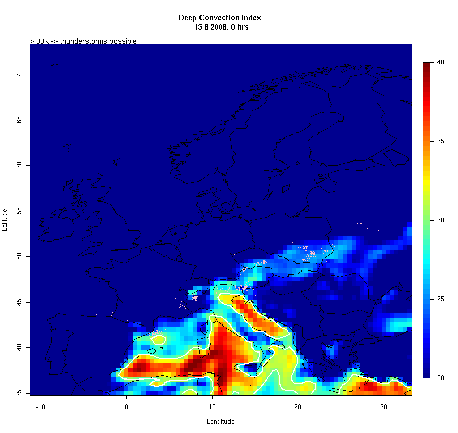
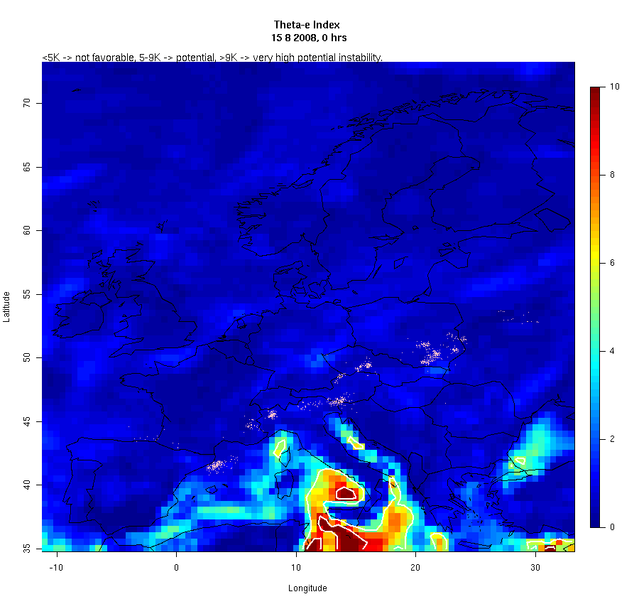
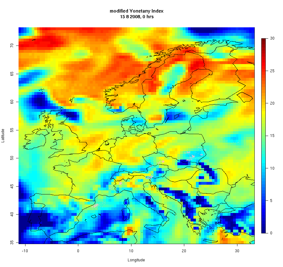
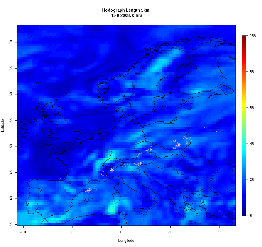
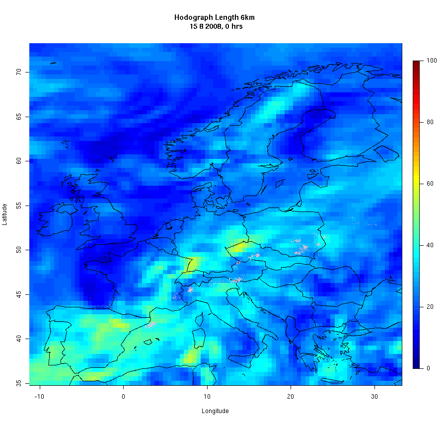
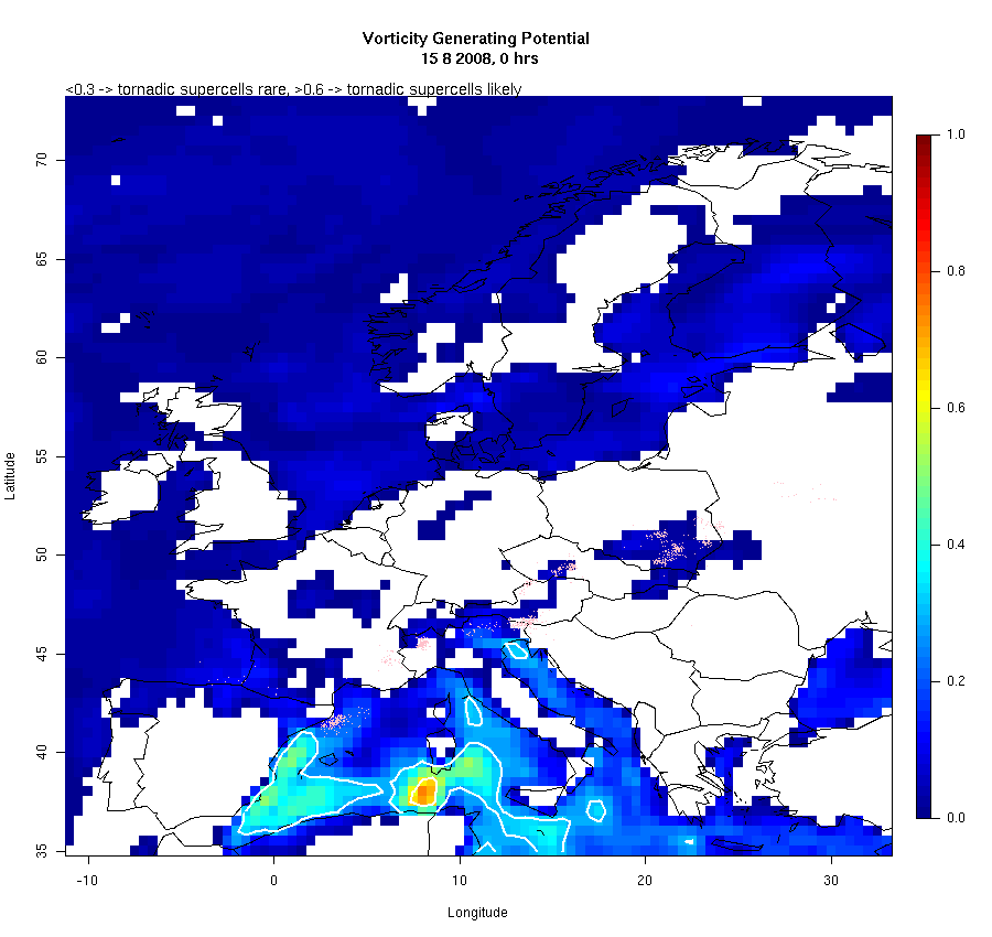
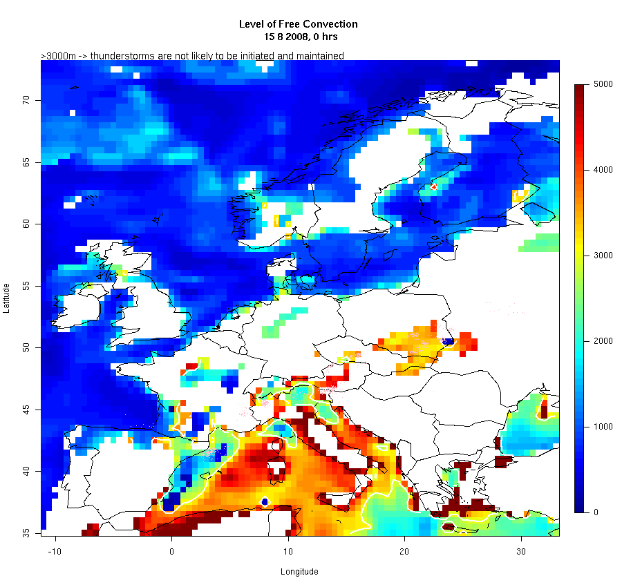
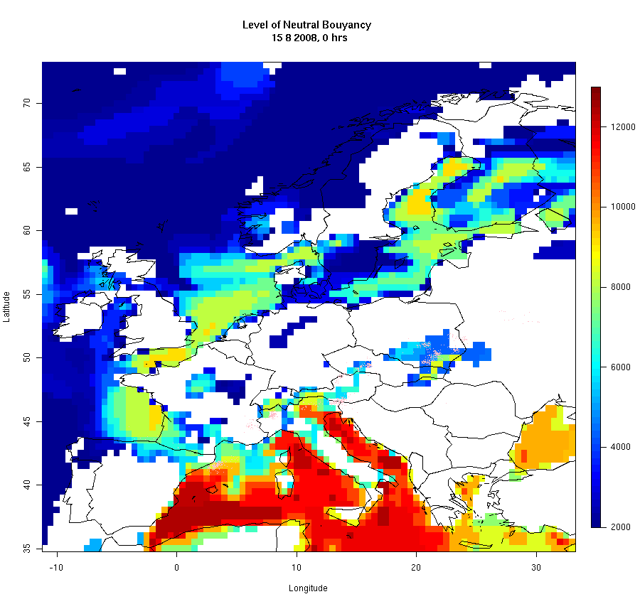
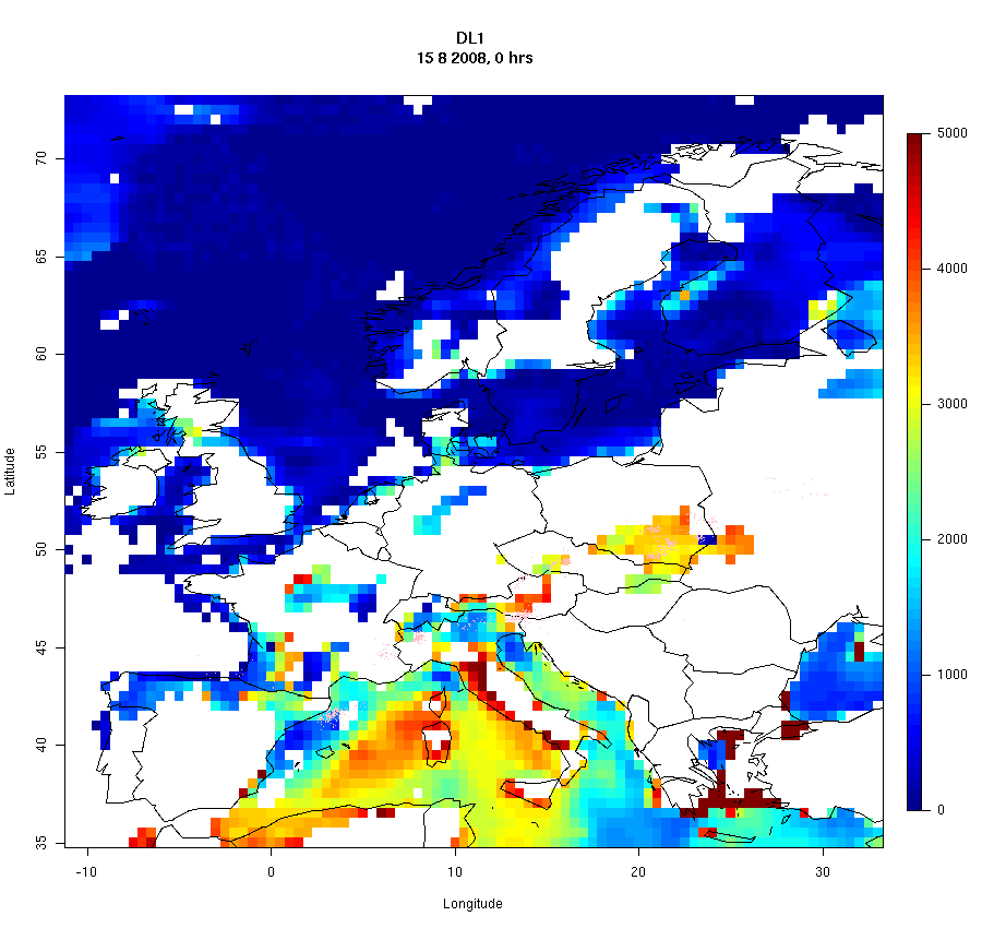
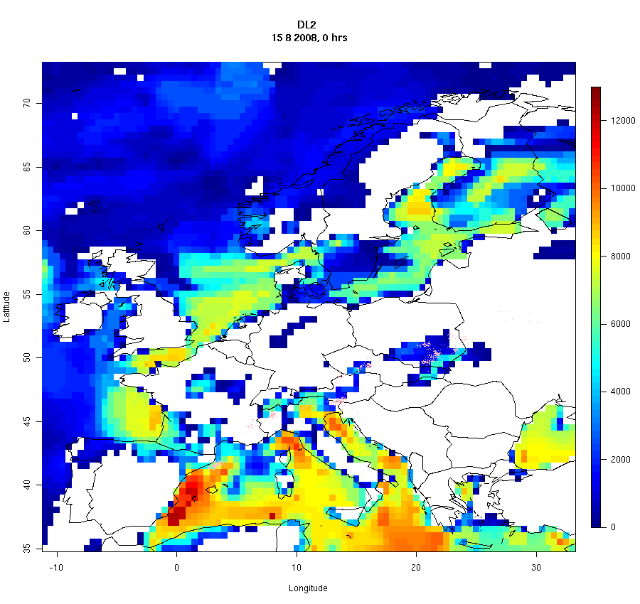
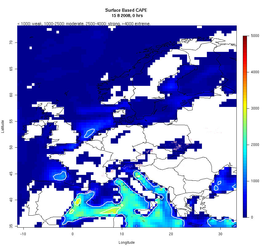
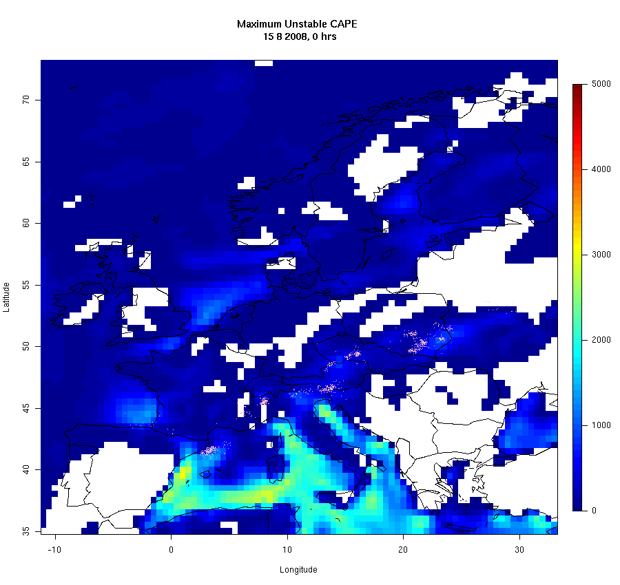
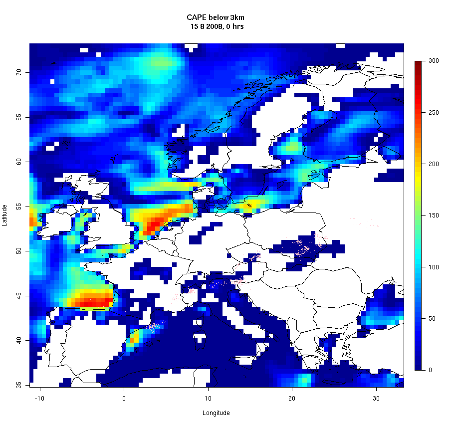
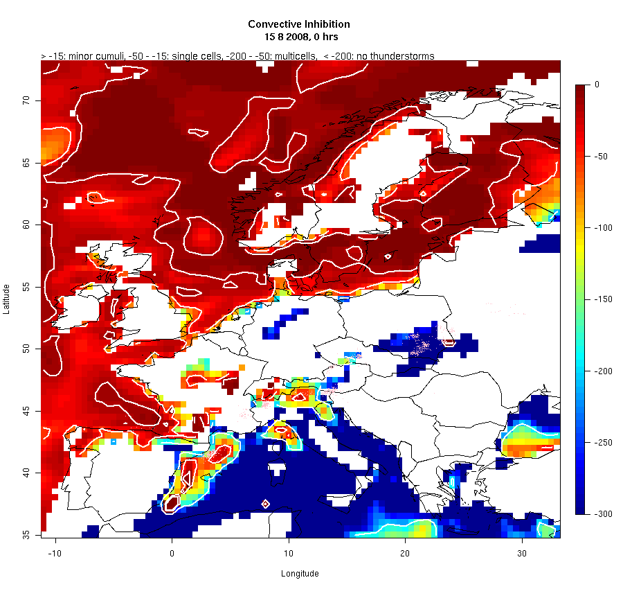
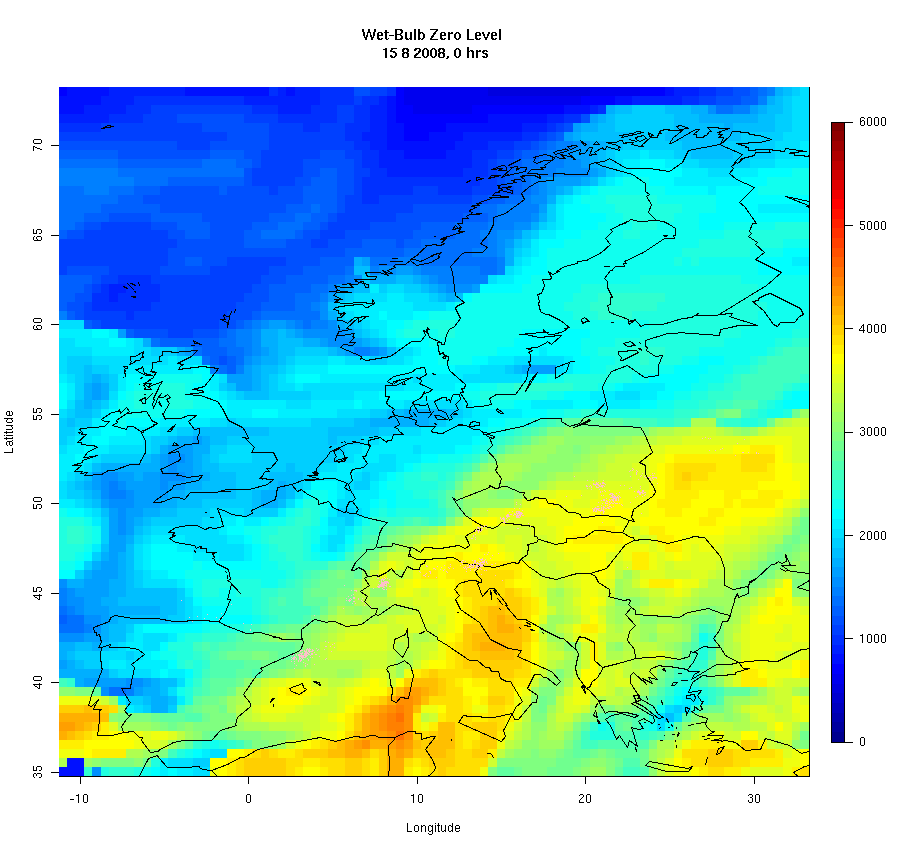
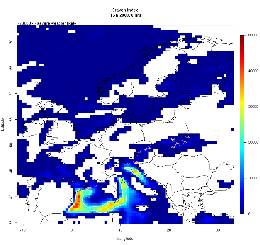
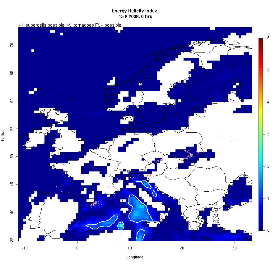
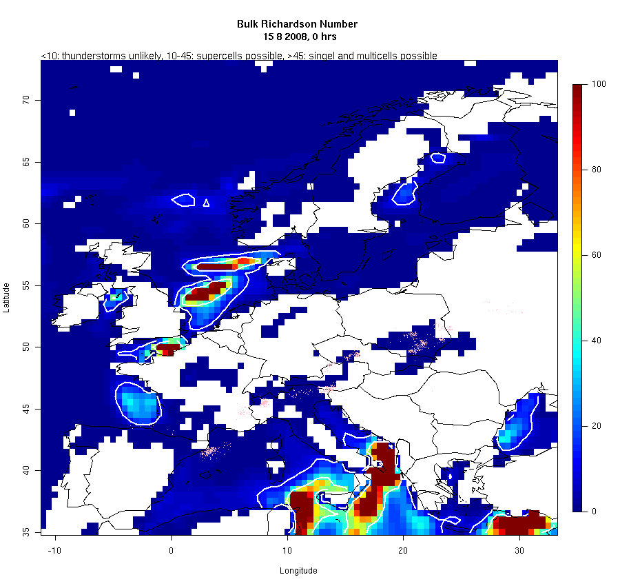
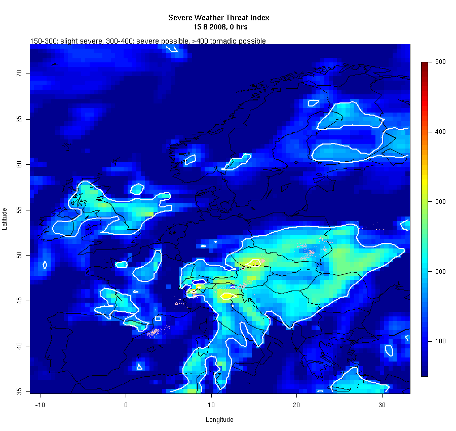
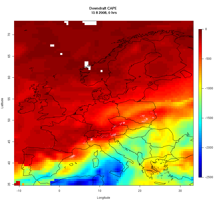
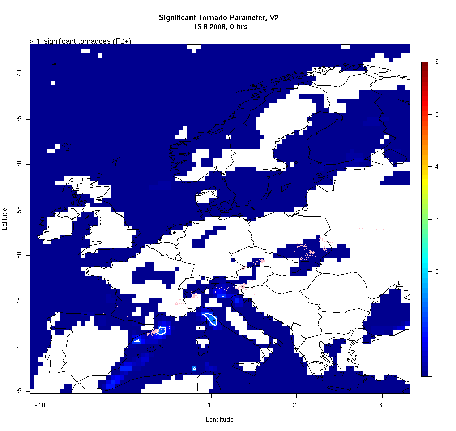
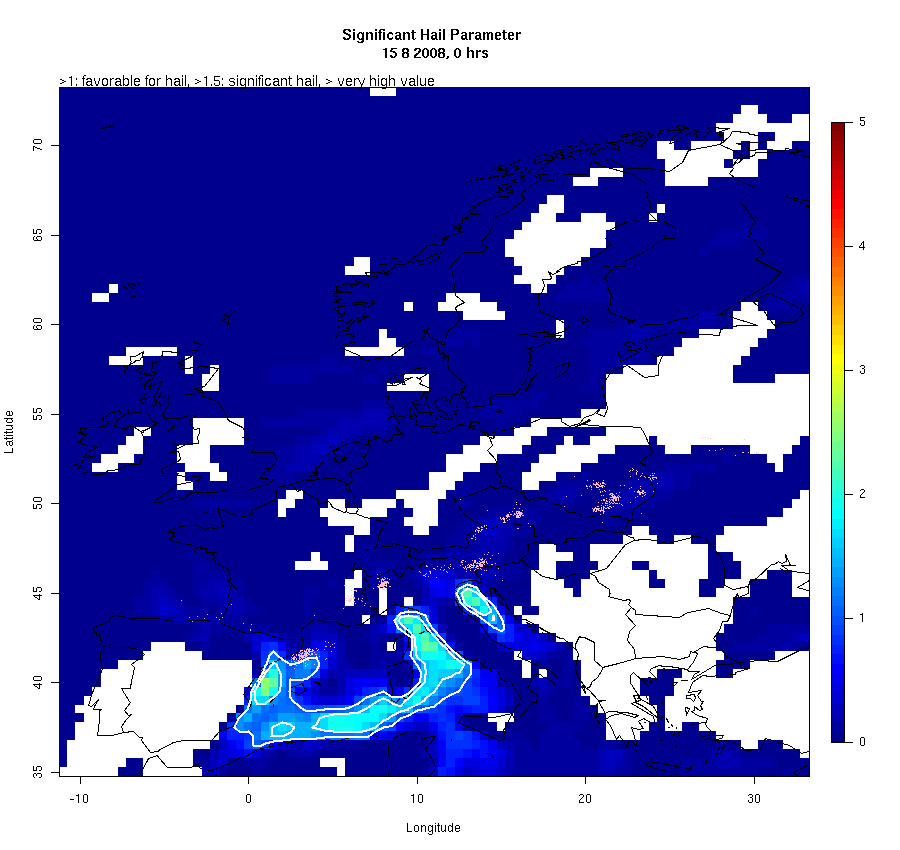
A bunch of convection parameters are calculated
for the 15th August 2008 based on CFSR 3hr forecasts. In order to
get an idea of how they do, they are visually compared to observed lightning
strokes within one hour before and after the CFSR forecast time. A detailed analysis of the weather of this
day (and others) can be found in the diploma thesis of Helge
Tushy. A description of the parameters is
provided here. I had no time for an analysis of the
results but want to share the images and leave it to a possible reader
(viewer that means) to be impressed by some results and disappointed by
others. The 8 images of each parameter are combined to an animated gif. The parameters come in 5 groups.
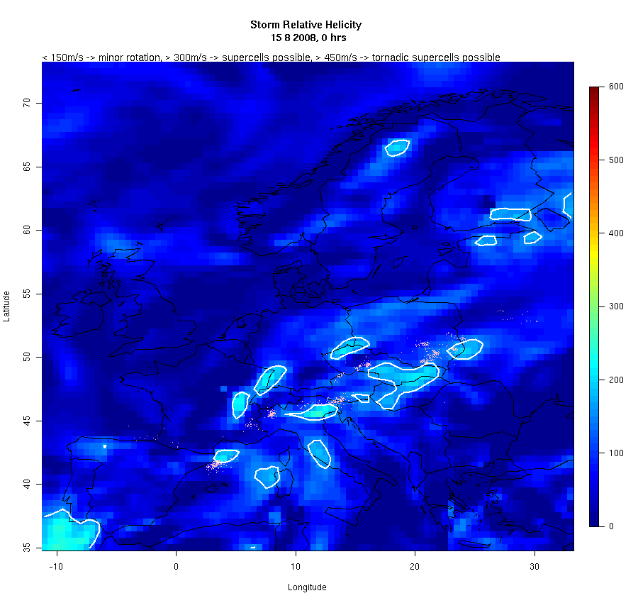
Locations of lightning strokes are shown as pink dots. |
|
Temperature-based Indices |
|
|
|
|
|
Temperature and Humidity based Indices |
|
|
|
|
|
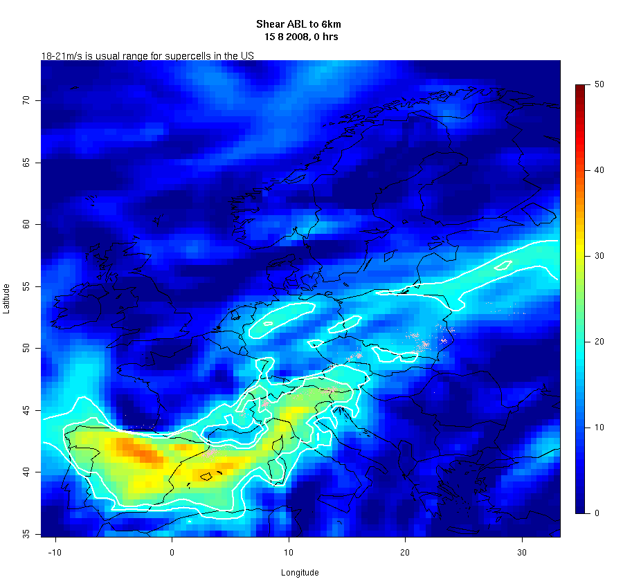
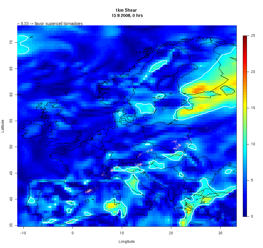
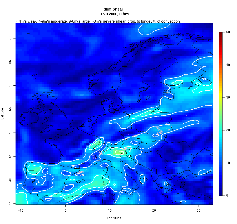
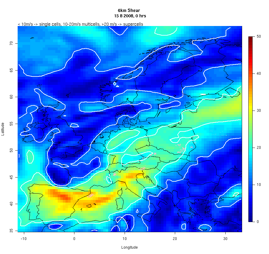
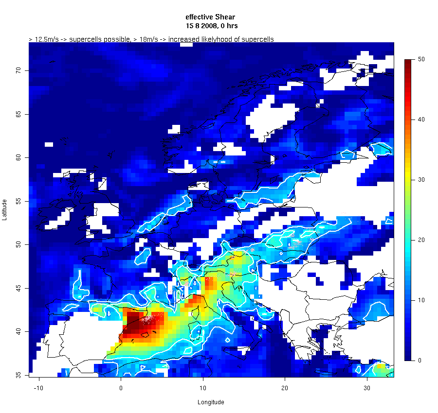
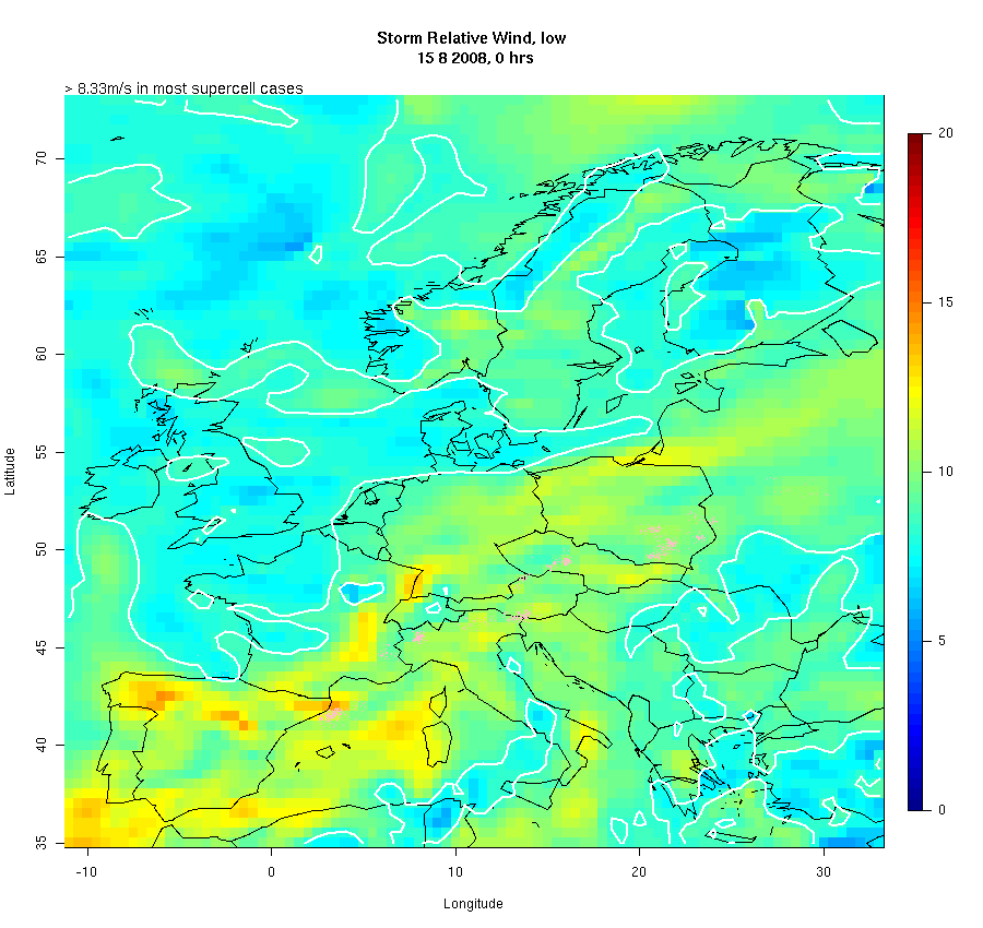
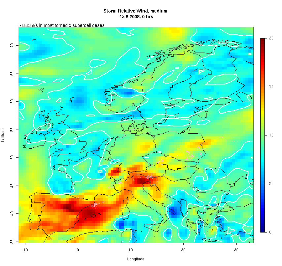
Wind-related Parameters |
Vertical Shear Boundary Layer to 6km Effective Bulk Shear (LPL to EL) Storm Relative Wind Surface to 2km Storm Relative Wind 4km to 6km |
|
|
|
|
Advanced Parameters |
Lifted Condensation Level (LCL) Mixed-Layer Lifted Condensation Level Level of Free Convection (LFC) Surface-Based Convective Available
Potential Energy (SBCAPE) |
|
|
|
|
Thematic Parameters |
Severe Weather Threat Index (SWEAT) Significant Tornado Parameter V1 Significant Tornado Parameter V2 |